
Mapping and Surveying with Drones
Mapping and surveying with drones in the agriculture sector have become increasingly popular for obtaining accurate information about crops. Drones have revolutionized how we map and survey land, making it faster, cheaper, and more accurate.
This article will explore drone mapping and surveying applications across the agriculture sector.
Mapping and Surveying with Drones in Farming: Revolutionizing Agriculture
Agriculture has been revolutionized over the past few years with the advent of technology, like drones for mapping and surveying in farming. Drones or unmanned aerial vehicles (UAVs) can be equipped with sensors and cameras to capture high-resolution images and data.
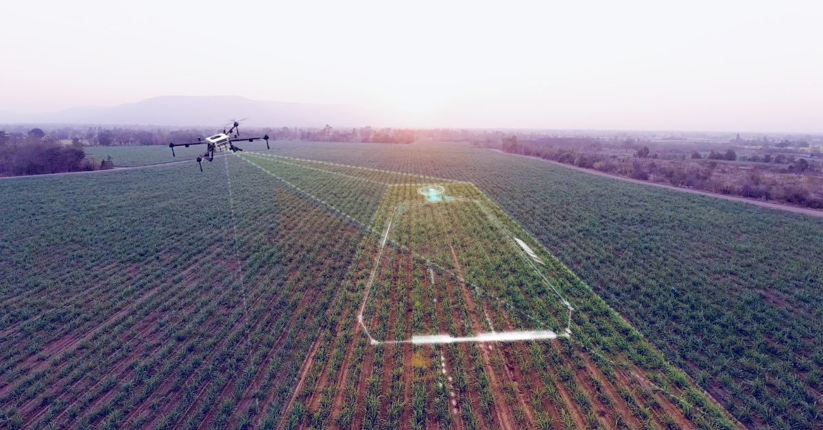
Drones are an ideal and cheaper alternative to aerial photography through planes and helicopters. These tiny yet booming technologies can fly at high altitudes, cover large areas quickly and accurately, and capture high-resolution images of forests, roads, and water through mapping.
Mapping with drones has become essential for farmers to monitor their crops, identify problem areas, and improve their yield. Drones can help farmers to assess crop health, estimate yield, determine water stress, detect crop diseases, and plan field operations. Mapping with drones can also help farmers to optimize their use of resources, such as water, fertilizer, and pesticides.
The New Gen Tech to Better Access & Improve Efficiency
One of the most significant advantages of drone mapping is the speed and accuracy with which it performs tasks. Drones can scout a large area a fraction of the time with detailed information that can help the farmer make better decisions and improve their yields. As the technology continues to advance and become more accessible, we can expect to see more farmers adopting drones for mapping and other applications in farming.
Farmers have used surveying techniques for centuries to measure and map their land. However, traditional surveying methods can be time-consuming and labour-intensive, making covering large areas difficult. Drones offer farmers a fast and efficient way to survey their land and improve their farming operations.
Drones are also used to survey fields and collect crop health data. Surveying in agriculture involves using drones to collect data about the topography and terrain of farmland. The data collected is then used to design 3D maps and models of the field to help farmers make more informed decisions about land use, drainage, and soil management.
How Does TerraTech Revolutionize Agriculture?
The future of farming – TerraTech is paving the way for efficient farming practices to help increase crop yield and, eventually, conserve the environment. This revolutionary technology combines precision agriculture, mapping, satellite imagery, and machine learning to optimize farming practices.
TerraTech has a plethora of benefits to help large-scale commercial agriculture and small-scale farmers yield maximum profitability.
Improved Crop Yield: TerraTech helps farmers analyze soil quality, weather conditions, and other environmental factors to prevent traditional farming operations.
Better Resource Utilization: With TerraTech, resources such as water, fertilizers, and pesticides are used efficiently. This tremendously benefits cost management and positively impacts the environment.
Increased Profitability: The lesser the use of traditional farming practices such as manual labour, the lesser the cost, ultimately resulting in increased profitability.
Better Decision Making: This technology provides farmers and agriculture researchers with real-time data and insights to make better, more informed decisions.
It has the potential to revolutionize how we produce food and make agriculture more sustainable. With its benefits, such as improved crop yield, better resource utilization, reduced environmental impact, increased profitability, and better decision-making, TerraTech is a must-have for farmers who want to stay ahead.
Conclusion
In conclusion, drones have tremendous potential to transform the agriculture industry. They can help farmers save time, reduce costs, and increase efficiency while providing more precise and detailed information about their crops.
With the growing demand for sustainable and environmentally friendly farming practices, drones offer a promising solution to minimize the use of chemicals and maximize yield. Furthermore, as drones become more advanced and affordable, they have the potential to transform farming into a more efficient, sustainable, and proficient industry.